


Maps and Perimeters of California Wildfires by Year
The Consolidated Appropriations Act, 2021 (CAA) provided CTCAC with additional 9% federal tax credits for multifamily housing projects in certain disaster areas, in recognition of the recent disasters occurring in California. The disaster areas defined in the CAA are located in 22 of California’s 58 counties: Butte, Fresno, Lake, Lassen, Los Angeles, Madera, Mendocino, Monterey, Napa, San Bernardino, San Diego, San Mateo, Santa Clara, Santa Cruz, Shasta, Siskiyou, Solano, Sonoma, Stanislaus, Trinity, Tulare, and Yolo. Applicants may apply for disaster area federal tax credits provided CTCAC regulation and program requirements are met. For the 2017, 2018 and 2020 disaster area fire perimeters referenced in CTCAC Regulation §10325, CTCAC is utilizing CAL FIRE and ArcGIS visual representations. See below for information on how to access these.
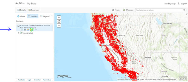
The CAL FIRE Fire Perimeters webpage has information and map links for historical fire data. The following ArcGIS webpage provides access to fire perimeters by calendar year.
On the ArcGIS webpage, click on ArcGIS.com Map. On the webpage left pane, hover over the California Fire Perimeters link. Click on the Filter icon below the link.
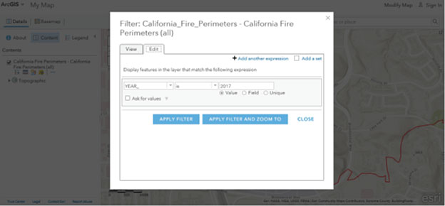
A pop-up box appears. Insert the 2017 year as shown below, then click Apply Filter:
The resulting map can be zoomed in for viewing individual fire perimeters:
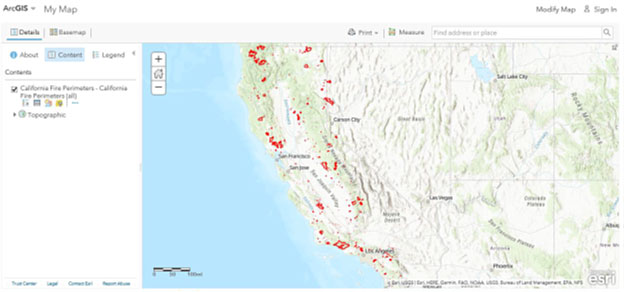
An address may be inserted in the address box to view site locations and their proximity to fire perimeters.
Repeat these steps on a separate webpage for the 2018 and 2020 wildfire perimeters.